Pak Phli, Nakhon Nayok, Thailand
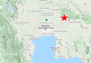
In the interior of Thailand’s central plain, below Khao Yai, the land becomes a mix of semiarid ranchland and scrub, along with fish ponds, rice paddies, and other cropland. In this habitat at Pak Phli there is a traditional winter roosting area for hundreds, sometimes thousands, of Black Kites. The surrounding area supports an unusually high diversity of grassland and waterbirds that often include Spot-billed Pelican, Oriental Darter, Eastern Marsh- and Pied Harriers, Long-tailed Shrike, Striated Grassbird, Australasian and Indochinese Bush-Larks, Rosy and Red-throated Pipits, and Chestnut-eared Bunting.
Orientation
Directions
Pak Phli is about 2 hours’ drive (120 km) east-northeast of downtown Bangkok, and about 30 minutes’ drive (25 km) southwest of the southern entrance to Khao Yai National Park. Many visitors to the park include a stop at Pak Phli on their itineraries—and the approach from threre is more straightforward than the approach from Bangkok.
From Khao Yai National Park, Southern Entrance Gate. Take Route 3077 south for 8.8 km, then turn west onto a small road that is a shortcut to Route 33 westbound. If you miss this turn, just continue on Route 3077 for another 3 km to Route 33 and turn west.
Route 33 is mostly straight for about 8 km after the shortcut (or about 11 km from Route 3077), then it bends north. Slow down on this bend, pull over to the left and take a very sharp left turn southward into the town of Pak Phli.
After 1.5 km, just past the temple, you will reach the only significant junction in the town. Turn right (i.e., south) and proceed 4.4 km to the temple Wat Khok Samrong Samakki Tham. Pass this temple, and cross the small bridge over a canal, then immediately turn left (east) into the site.
From Bangkok. There are three main routes from the Bangkok metropolitan area to Pak Phli: (1) a northern route via Nakhon Nayok; (2) a middle route via Lam Luk Ka; and (3) a southern route via Lat Krabang. Although the efficiency of each option depends on the starting point in Bangkok, they take roughly the same amount of time—unless the traffic conditions are significantly worse somewhere along the way (which seems to be common). The northern route is less direct, but it is simpler and uses faster roads than the others.
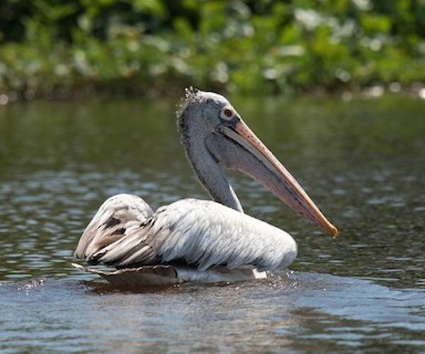
Spot-billed Pelican. © Aaron Lang
To take the northern route from Bangkok, begin northbound on the Chalong Rat Expressway, which merges into the Route 9 freeway just north of the Safari World theme park. After another 6 km, exit onto Route 305 (the main highway from Rangsit to Nakhon Nayok) eastbound, then stay on this road for approximately 62 km to Nakhon Nayok, where it merges into Route 33 eastbound. Remain on Route 33 for 10.7 km and just past the bend described above, make a U-turn, and return about 900 m to take the very sharp left turn southward into the town of Pak Phli. Then follow the same directions to Wat Khok Samrong Samakki Tham and into the site.
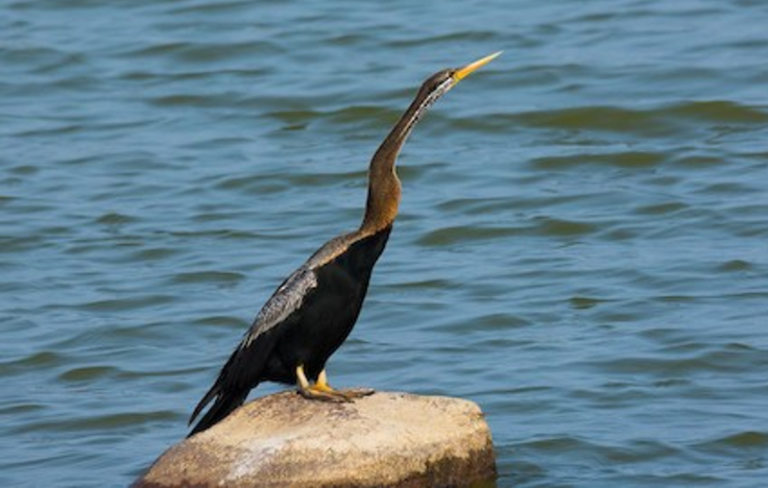
Oriental Darter. © Eric François Roualet
To take the middle route from Bangkok, begin northbound on the Chalong Rat Expressway. 2 km past the merge into Route 9, exit onto Route 3312 (Lam Luk Ka Road) eastbound, then remain on this road (which becomes Route 4009) for approximately 41 km to Wat Sunthon Phichitram, where it ends at a T-junction. Turn right onto Route 3001, go 350 m, then turn left onto Route 3076. After 4 km, turn left, then right onto Route 4002, then remain on this road for about 23 km to Ban Ko Ka, where it obliquely feeds into another road. At the oblique junction make a sharp right turn to head southeast along a canal. After 3.6 km, turn left to take the bridge over the canal, then turn right again to parallel the canal for another 500 m to arrive at the south end of the site.
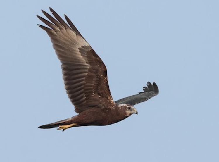
Female Eastern Marsh-Harrier. © Natthaphat Chotjuckdikul
To take the southern route from Bangkok, begin by taking Thanon Chalong Krung northeast from Lat Krabang to Route 304. Turn left onto Route 304, then make the first available U-turn to head east on Route 304. After 10 km, turn left onto Route 3481, and remain on it for 43 km, where it merges into Route 3076 northbound. The road will immediately zigzag through the village of Ban Sang and cross a river (Bang Pakong). About 3 km north of the river, turn right onto Route 4002, then remain on it for 11 km to Ban Ko Ka—the oblique junction described above. Make the sharp right turn to head southeast and arrive at the south end of the site, as described above.
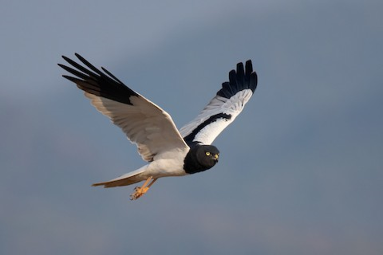
Male Pied Harrier. © Ayuwat Jearwattanakanok
Birdfinding
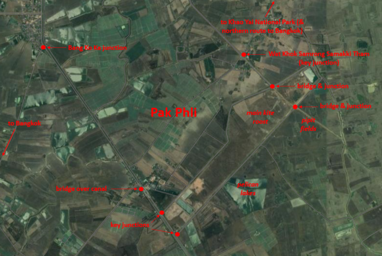
Pak Phli is a large open site that is best explored by vehicle. The simplest way to understand it is as a loop road around the perimeter of a long plot of land. Anywhere along the loop road can be productive, but there are three areas of primary interest: (1) the “kite roost”; (2) the “pipit fields”; and (3) the “pelican lakes.”
Kite Roost. At the northern end of the site, within the perimeter of the loop, there are many widely spaced trees that are either dead or seasonally leafless. In winter, hundreds of Black Kites (almost all of which are the migratory “Black-eared” form) arrive in the late afternoon and depart in the first hour or so after dawn.
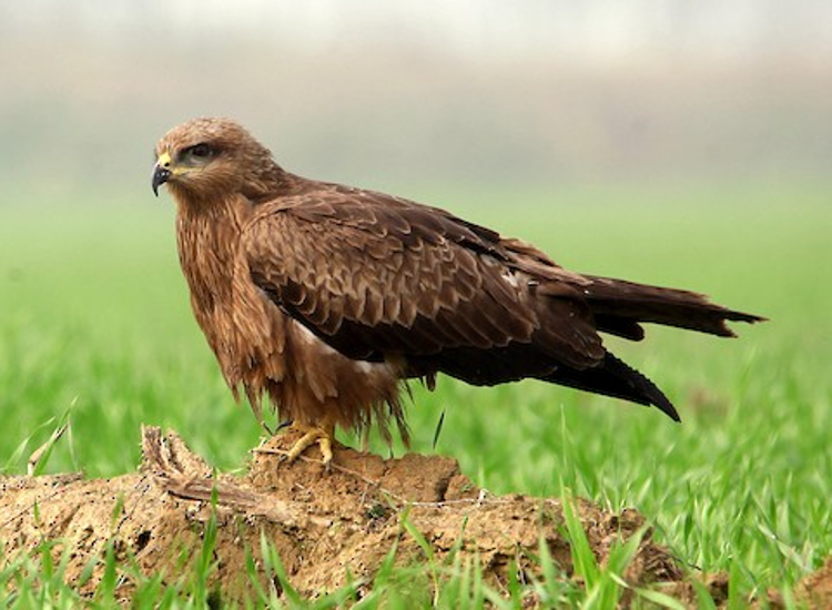
“Black-eared Kite.” © Jayant Atrey
Several other raptors are likely to be present in much smaller numbers, including: the resident Black Kite form, Black-shouldered Kite, Booted Eagle, Greater Spotted Eagle, Eastern Marsh- and Pied Harriers, and Western Osprey. There are also a few winter records of Himalayan Griffon Vulture and Eastern Imperial and Steppe Eagles. During migration periods, the assemblage sometimes swells and may also include Oriental Honey-Buzzard, Gray-faced Buzzard, among others.
While the bulk of the kites (plus a few other raptors) roost in the northern part of the loop, as described above, smaller concentrations often use other clusters of trees elsewhere in the general vicinity.
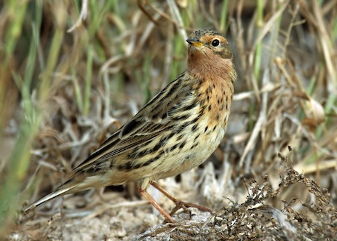
Red-throated Pipit. © John Thompson
Pipit Fields. Just east of the kite roost, outside the perimeter of the loop, is an area of barren fields that has a history of hosting several species of pipits, larks, and other open-land passerines, especially in mid-winter.
The expected (or at least somewhat likely) species in winter include: Bluethroat, Siberian Stonechat, Oriental Skylark, Indochinese and Australasian Bush-Larks, Eastern Yellow Wagtail, Paddyfield, Richard’s, Red-throated, and Rosy Pipits, Red Avadavat, Scaly-breasted Munia, and Chestnut-eared Bunting. The highlights among these are Australasian Bush-Lark, Rosy Pipit, and Chestnut-eared Bunting, all of which are generally difficult to find in Thailand.
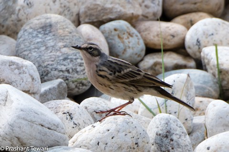
Rosy Pipit. © Prashant Tewari
The junction at the northeast corner of the loop, between the kite roost and the pipit fields, is among the last places in central Thailand where Long-tailed Shrike continues to be found regularly—or, in any case, this was its status as of early 2020.
Driving south along the loop road, watch the marshy ditches and adjacent bushes for Striated Grassbird, reed- and bush-warblers, Baya and Asian Golden Weavers, and Plain-backed Sparrow.
Pelican Lakes. About 3 km south of the pipit fields, the loop road passes a set of very large ponds, outside the perimeter, that host large flocks of cormorants, egrets, and storks, which are often joined by a few less common waterbirds, including Spot-billed Pelican and Oriental Darter.
South of the “pelican lakes” are a handful of smaller ponds that often add some shier waterbirds, including Yellow, Cinnamon, and Black Bitterns, Purple Heron, White-breasted Waterhen, Watercock, and Bronze-winged Jacana.
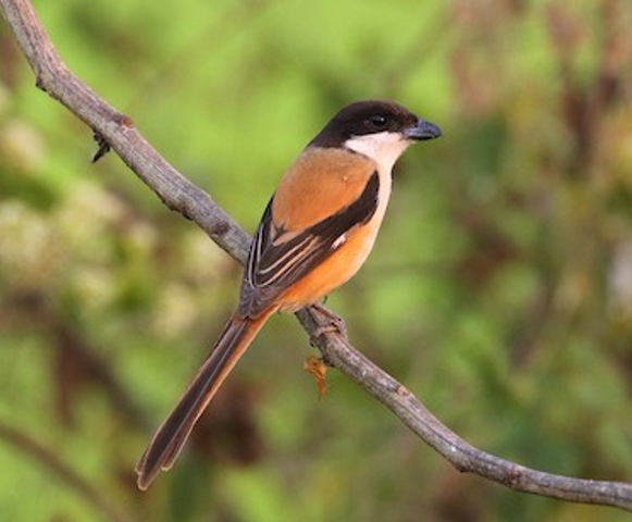
Long-tailed Shrike. © Carlos Sanchez
Note that the southwesternmost point of the loop is a junction that is the closest point to arrive from or depart toward Bangkok.
Notes
When to Visit
Seasonally. The kite roost is active from around September to April, but some of the rarer birds that have been found at Pak Phli (such as Eastern Imperial Eagle and Rosy Pipit) appear to have a narrow window: roughly late December into February.
Daily. The spectacle of swarming kites is best observed in the early morning or late afternoon, so most visitors plan to arrive early or leave late and add two or three hours to explore other areas around the loop.