Hardwar Gap, Jamaica
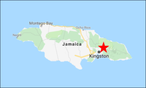
At the crest of the Port Royal Mountains, overlooking the urban jungle of Kingston, Hardwar Gap is the gateway to the Blue and John Crow Mountains National Park, a UNESCO World Heritage Site. The road up from Kingston is narrow and twisty, but paved, providing convenient access to the cloud forest. This is the ideal place to search for some of Jamaica’s most elusive endemic birds: Crested Quail-Dove, Jamaican Owl, Small and Large Jamaican Elaenias, Blue Mountain Vireo, “Jamaican Solitaire,” and Jamaican Blackbird.
Orientation
Directions
Hardwar Gap is about 45 minutes’ drive (20 km) from the eastern suburbs of Kingston on the direct route (a.k.a. the B1) over the mountains to Buff Bay.
Start in Kingston on Old Hope Road eastbound, past Jamaica College, Hope Gardens, and the University of Technology (UTECH) en route to the Papine neighborhood.
As it passes UTECH, Old Hope Road bends left to wrap around the campus, and becomes Gordon Town Road. After 2.8 km, turn left onto Irish Town Road (staying on Gordon Town Road would take you to Mavis Bank). There are several handmade signs pointing left to B&Bs, but this fork is easy to miss.
2.2 km further, fork right to remain on Irish Town Road, which ascends for another 16 steep and winding kilometers to the Jamaican Defense Force (JDF) base at Newcastle, the unofficial entry point to the Hardwar Gap area.
Scam Alert. If you intend to continue on Route B1 down to Buff Bay (about 35 km beyond Hardwar Gap), be aware that locals in Section (4 km past The Gap Café) have been running a scam to prey on tourists. As you arrive from Hardwar Gap, the main road may be blocked for construction where a landslide made it impassable—presumably it will be repaired eventually, but until then there will be potential for confusion. Just before the blockage, another road goes uphill to the left—this is the road to Buff Bay and you should simply continue on that road without stopping. If you stop to ask for directions, the locals may say that this road is private and charge an informal toll.
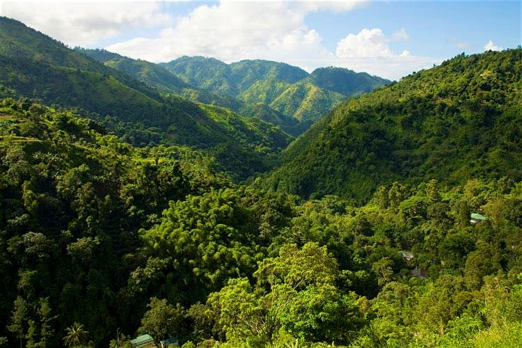
Blue Mountains vista.
Birdfinding
Anywhere in the Hardwar Gap area—meaning the 8 km stretch of the main road (the B1) from Newcastle to Section, plus the several side-roads—can be productive for birds, and most of the sought-after species can occur anywhere in the area. Many visitors spend at least part of their visit walking along the main road, especially between Newcastle and the Gap Café, which affords many good vantage points for observation and usually has little traffic.
Notable birds often found along the main road include Ring-tailed Pigeon, Red-billed Streamertail, Vervain Hummingbird, Jamaican Tody, Large Jamaican Elaenia (mostly April to October), Jamaican Pewee, Rufous-tailed and Sad Flycatchers, Loggerhead Kingbird, Jamaican Vireo, Jamaican Euphonia, Jamaican Oriole, Arrowhead Warbler, Jamaican Spindalis, Orangequit, Greater Antillean Bullfinch, and Yellow-shouldered Grassquit.
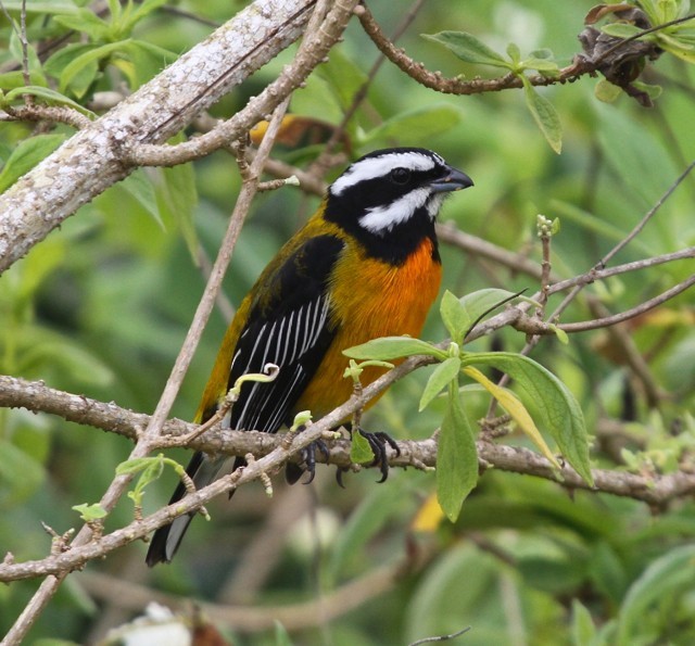
Male Jamaican Spindalis at Silver Hill Gap. © Frank Mantlik
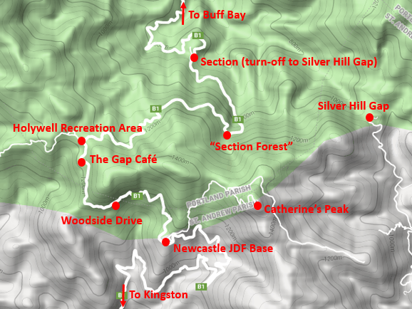
Favored spots in the Hardwar Gap area include: Route B1 between Newcastle and the Gap Café, Woodside Drive, the side-road below Catherine’s Peak, the “Section Forest,” and Silver Hill Gap.
In addition to walking the main road between Newcastle and the Gap Café, there are many other productive areas to visit:
Catherine’s Peak. Catherine’s Peak is a prominent point in the Port Royal Mountains, overlooking Kingston and the Yallahs River Valley, with a view of the Blue Mountains. The road up to Catherine’s Peak starts inside the Newcastle JDF base—immediately to your right as the main road enters the parade grounds en route from Kingston. Turn here, and follow the steep, concrete road for about 1.5 km to a junction with a pull-off on the right where you can park.
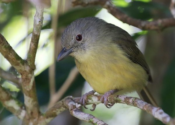
Blue Mountain Vireo at Hardwar Gap. © Matthew Grube
From the parking spot, you have three walking options: back downhill toward the base; uphill to the peak; and the side road to the left, which leads to a coffee plantation. Any of these can be productive, but the side road is easier walking and usually affords better viewing opportunities.
After a short uphill section, it becomes essentially level and an easy walk through the forest, with a high probability of Large Jamaican Elaenia and Blue Mountain Vireo, and a lower but reasonable chance of Jamaican Becard and Jamaican Blackbird.
Alternatively, continuing uphill instead, the road winds up to Catherine’s Peak, becoming progressively steeper and often more slippery as it climbs. This road is good first thing in the morning for forest interior birds such as Crested Quail-Dove, “Jamaican Solitaire,” and White-eyed Thrush.
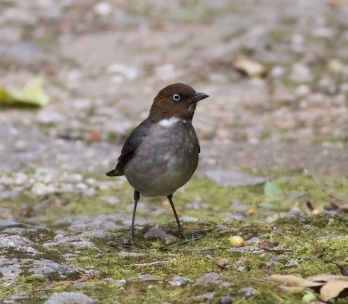
White-eyed Thrush at Hardwar Gap. © Tom Johnson
Woodside Drive. Along Route B1, 1.6 km past the Newcastle JDF parade grounds, a side-road leads steeply downhill to the left, ultimately arriving at villa called Woodside. This short track rivals Ecclesdown Road for productivity, and has been reliable for several sought-after species: Jamaican Owl, “Caribbean Potoo,” Crested Quail-Dove, Small Jamaican Elaenia, and Jamaican Becard.
To find the Jamaican Owl, it is best to arrive an hour or more before dawn, quietly stroll down the track, and listen or broadcast the call. Actually finding the owl is never guaranteed, but this is among the best places to try for it.
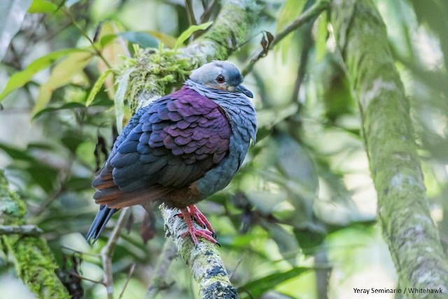
Crested Quail-Dove along Woodside Drive. © Yeray Seminario
The Gap Café. Approximately 1.2 km past Woodside Drive is the landmark Gap Café on the left. This is a traditional breakfast, lunch, dinner, or snack spot near the crest of the ridge.
The rear patio of the restaurant has tables beside bird feeders that attract Red-billed Streamertail, Vervain Hummingbird, Orangequit, and Jamaican Oriole. Crested Quail-Dove, Large Jamaican Elaenia, and Jamaican Blackbird can sometimes be found at the edge of the forest immediately behind or beside the café.
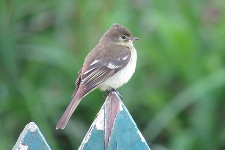
Large Jamaican Elaenia at Hardwar Gap. © Garrett MacDonald
Holywell Recreation Area. 200 m past the Gap Café, also on the left, is the gated entrance to the Holywell Recreation Area (often inaccurately referred to as Holywell National Park): the day use entrance fee for foreign visitors is US$10. For the general public of Kingston, this is the default destination for an outing to Hardwar Gap. As such, it is the place with the highest volume of foot traffic and loud groups, and therefore best to avoid on weekends and holidays—especially when it hosts a music festival.
The Recreation Area has amenities, including a visitor center, bathrooms, picnic gazebos, campsites and three cabins for overnight accommodations, and five nature trails leading into the forest. In ascending order of length and strenuousness, these are: the Blue Mahoe Trail (350 m); the Shelter Trail (600 m); the Wag Water Trail (630 m); the Oately Mountain Trail (1,200 m); and the Waterfall Trail (1,300 m). Any of them could be productive, but the Waterfall Trail is noted for Jamaican Blackbird.
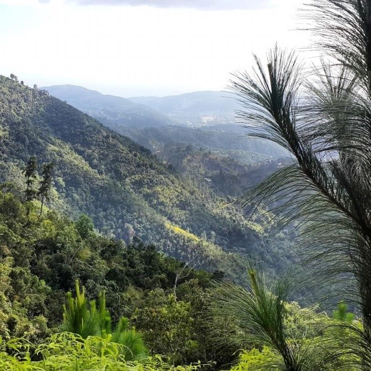
View from Holywell Recreation Area.
Section Forest. Starting approximately 3.3 km past Holywell, the road enters an excellent patch of virgin forest with very tall trees, profuse with bromeliads. This is the most reliable area for Jamaican Blackbird, particularly in the deep ravine along the hairpin turn, with the tallest trees and best visibility into the sub-canopy, and one of the best areas for Crested Quail-Dove and both Small and Large Jamaican Elaenias, as well as the full complement of montane endemics. The road continues through excellent forest for over a kilometer, nearly all the way to the hamlet of Section.
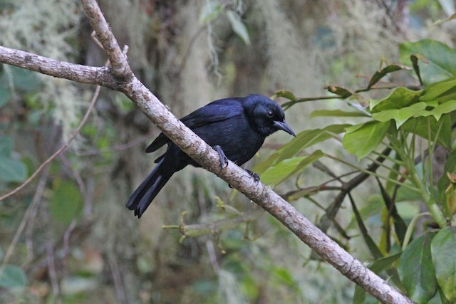
Jamaican Blackbird at Hardwar Gap. © Michael McCloy
Silver Hill Gap. Approximately 4.8 km past Holywell, Route B1 emerges from the forest and enters the small settlement called Section. Here a road on the right goes uphill to Silver Hill Gap, which is the saddle between the Port Royal Mountains and the Blue Mountains. Many birdwatchers visit Silver Hill Gap to stay at the Starlight Chalet and Health Spa (about 3 km uphill from Section).
The road from Section to Silver Hill Gap goes through good forest, and often has a resident pair of Jamaican Owls that are cooperative for observation. This road may not always be passable for regular passenger cars.
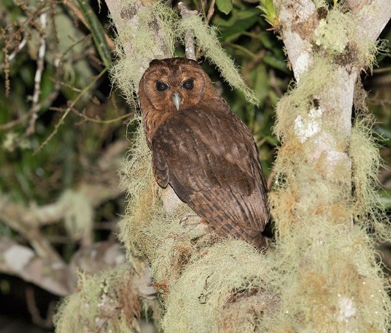
Jamaican Owl at Silver Hill Gap. © Sam Woods
Services
Accommodations
Hardwar Gap is easily accessible from Kingston and any of its hotels, but most birdwatchers prefer to stay at one of the several mountain retreats near the Gap.
At Hardwar Gap itself there are two rustic options: The Gap Café has a bed-&-breakfast-style apartment attached to the restaurant, and Holywell Recreation Area has three cabins that can be rented through the Jamaica Conservation and Development Trust.
Also in the immediate vicinity and located in excellent bird habitat are: the hotel Starlight Chalet and Health Spa at Silver Hill Gap, which has been the favored lodging for visiting birdwatchers in recent years, and Heritage Gardens of Cold Spring, a three-bedroom cottage constructed on the drying area of an 18th Century coffee factory, formerly part of the Cold Spring Estate, on Irish Town Road in Newcastle about 1.3 km below the JDF base.
Several km downslope, in Irish Town, two hotels that frequently host visitors to Hardwar Gap are Rafjam Bed & Breakfast and the upscale Strawberry Hill Jamaica Luxury Resort.
Food
Situated at the crest of Hardwar Gap, The Gap Café is the closest eatery.
A few km downhill from Newcastle, the EITS Café serves an eclectic menu of excellent food at reasonable prices. (This is the author’s favorite restaurant in Jamaica—highest recommendation.)
Two popular options farther downhill in Irish Town are Café Blue and the Irish Town Pub & Grill.
Notes
Hardwar Gap is best visited between January and April, when the odds of wet weather are lowest, bird song and mating behavior are highest, and North American migrant warblers are present. April is best for Large Jamaica Elaenia, which otherwise can be the hardest Jamaican endemic to find.
Keep in mind that this is a cloud forest. Fog, mist, and rain are common and should be expected on every visit, year-round. Hardwar Gap is at the crest of a mountain range, so the air is always flowing, the weather changes quickly, and conditions are often different on the two slopes. As a general rule, the southerly slope—facing Kingston—tends to be drier, and the best bet for clear weather is between Newcastle and the Gap Café, including Woodside Drive.